Geography Paper 1 Annexure - Grade 12 September 2021 Preparatory Exams
Share via Whatsapp Join our WhatsApp Group Join our Telegram GroupANNEXURE
FIGURE 1.2: TROPICAL CYCLONE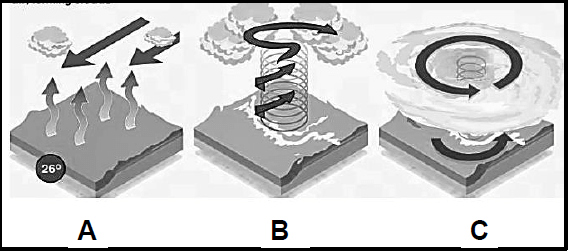
[Source: bing.com]
FIGURE 1.3: SYNOPTIC WEATHER MAP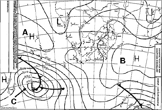
[Source: www.weathersa.co.za]
FIGURE 1.4: DEVELOPMENT OF BERGWINDS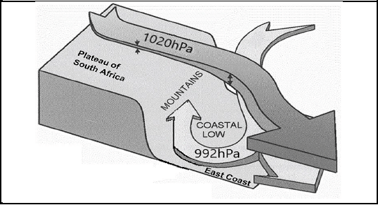
[Source: bing.com]
FIGURE 1.5: POLLUTION DOME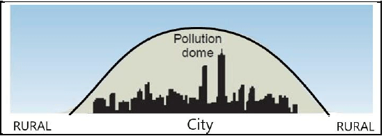
[Source: bing.com]
FIGURE 2.2: DRAINAGE PATTERNS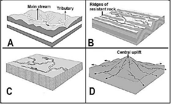
[Source: bing.com]
FIGURE 2.3: RIVER REJUVENATION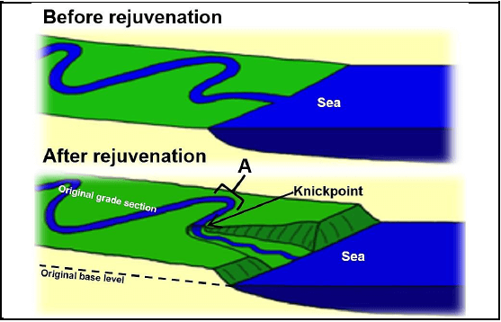
[Source: bing.com]
FIGURE 2.4: FLOODPLAINS
[Source: bing.com]
FIGURE 2.5: RIVER MANAGEMENT
Gauteng says it is working to fix Vaal River ecosystem The Vaal River, which about 19 million people depend on for drinking, domestic and commercial use, is polluted beyond acceptable standards. The cause is the kiloliters of untreated sewage entering the Vaal because of inoperative and dilapidated wastewater treatment plants. [Source: Timeslive.co.za] |
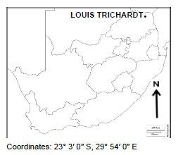
SECTION B: GENERAL INFORMATION ON LOUIS TRICHARDT
| Coordinates: 23° 3′ 0″ S, 29° 54′ 0″ E Louis Trichardt has a subtropical climate. |
